.
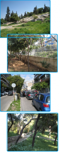
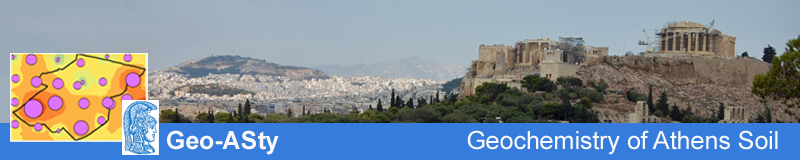
The study area was divided into 218 cells of 1×1 km in size. A sampling density of one sample per sq. km was adopted and the center of the cell was preferably determined as the sampling location. The sampling sites were selected to represent land use categories such as parks, recreational areas, playgrounds and school yards. Whenever sampling in these categories was not feasible, soil from road verges was collected. A total of 238 composite topsoil (0-10 cm) samples were collected in the spring and summer of 2012.
Sampling was carried out where plants with superficial roots were not present. Five subsamples were collected from the center and corners of a 10 m square to obtain a representative sample from each site. If this was not possible, the composite sample was obtained by collecting material from 5 points with at least 5 m distance from each other. At 20 randomly selected sampling sites a field duplicate sample was recovered at approximately 200 m distance, but within the same 1 × 1 km sampling cell. The exact geographical coordinates for each soil sample were recorded by GPS and field observations were archived. The sampling sites were also photographed for reference.

